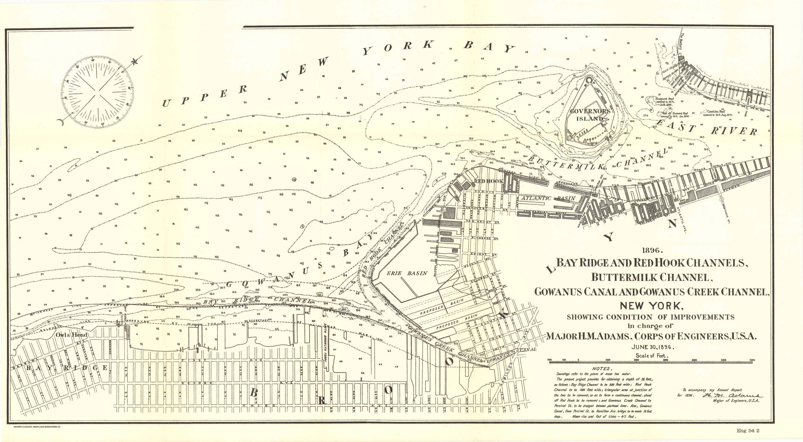
Map of Bay Ridge and Red Hook Channels, Buttermilk Channel, Gowanus Canal and Gowanus Creek Channel, New York 1896
Out of stock
This is a map of the Bay Ridge and Red Hook Channels, Buttermilk Channel, Gowanus Canal and Gowanus Creek Channel, New York, showing condition of improvements in charge of Major H.M. Adams Corps of Engineers, U.S.A. June 30th, 1896. This map is accompanied by a Notes section as well as the signature of Major H.M. Adams. Additionally, this map features Brooklyn, Upper New York Bay, the Erie Basin, Governors Island, Red Hook, Atlantic Basin, among other natural and man-made features shown on the map.
Size: 21 x 11 inches
Condition: Very good
Map Maker: U.S. Corps of Engineers
Original Production Year: 1896
Coloring: Black & White
Year: 1896
Condition: Very good
Map Maker: U.S. Corps of Engineers
Original Production Year: 1896
Coloring: Black & White
Year: 1896
Out of stock


