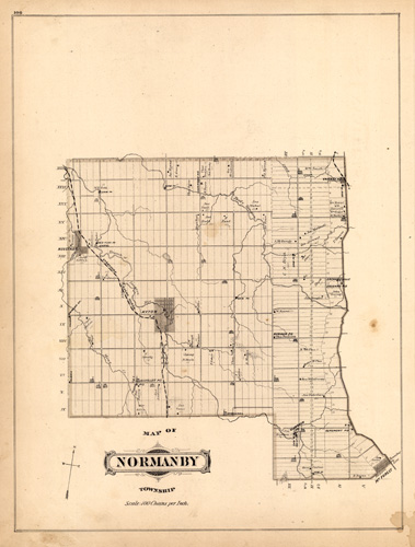
Map of Normanby Township, Ontarion, Canada
Out of stock
This map was originally produced as part of the “Illustrated Atlas of the Dominion of Canada Containing Authentic and Complete Maps of all the Provinces, the North-West Territories and the Islands of Newfoundland.” This maps shows churches, important buildings, Post Offices, railroads and property owners. We have never seen these maps and views in our over 35 years of map buying and selling. There are very few records of these maps selling in the last 30 years. Truly beautiful presentation.
Size: 12 x 13.75 inches
Condition: Very Good
Map Maker: H. Belden
Coloring: Printed Color
Year: 1880
Condition: Very Good
Map Maker: H. Belden
Coloring: Printed Color
Year: 1880
Out of stock


