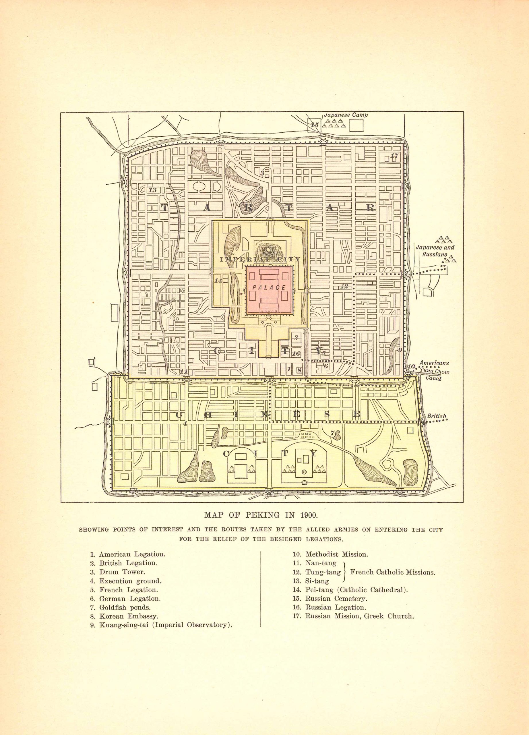
Map of Peking in 1900; Showing Routes of Interest and Routes Taken by Allied Armies Entering the City
Out of stock
These handsomely colored maps are from the 1896 Johnsons Universal Cyclopedia. Hand coloring from this time frame are rare. The small size of these maps allow for excellent framing. This particular map of the world shows the isotherms or lines of equal temperature.
Size: 5.75 x 7.5 inches
Condition: Excellent
Map Maker: A.J. Johnson
Coloring: Printed Color
Year: 1896
Condition: Excellent
Map Maker: A.J. Johnson
Coloring: Printed Color
Year: 1896
Out of stock


