 |
||
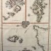
Map of Remote British Isles
Out of stock
This map is from Pinkerton’s Modern Atlas printed in 1815. The remote British Isles are illustrated on this map, including Jersey and Guernsey on the bottom half of the page and a map of the Scilly Isles on the left top quarter and the Shetland Isles on the right. The maps are in black and white with outlines of the islands in bright burgandy or yellow. Details include the names of islands and important cities, waterways, lakes and rivers, shading to represent rocks and shore lines, and labeling of important businesses and land owners.
Size: 20 x 27.5 inches
Condition: Excellent, light age toning
Map Maker: Pinkerton
Coloring: Black and White with Outlines
Year: 1815
Condition: Excellent, light age toning
Map Maker: Pinkerton
Coloring: Black and White with Outlines
Year: 1815
Out of stock