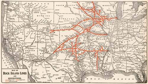
Map of Rock Island Lines and Connections
Out of stock
This map comes from a set of Railway maps that captures the US at a time when the Railroads were the arteries of commerce. While this map shows us a specific line, which is emboldened, there are numerous connecting lines shown, and one quickly can see the age when the rails were king. The maps are intended to be topical, so while every stop and whistle stop is shown on the rail lines, there typically isn”t much additional information shown which could clutter the image. Condition is wonderful on this map, which is clean, with just slight folds. A must for any railway enthusiast.
Size: 9 x 6.5 inches
Condition: Very Good
Map Maker: Moodys Manual'
Coloring: Black and white as issued
Year: 1937
Condition: Very Good
Map Maker: Moodys Manual'
Coloring: Black and white as issued
Year: 1937
Out of stock


