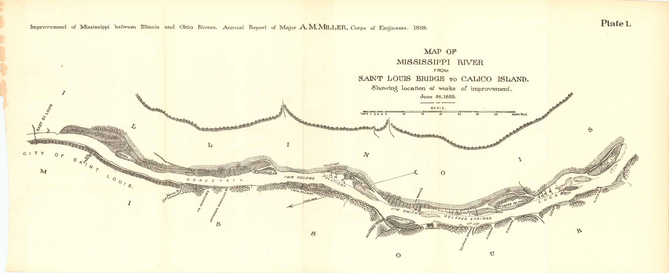
Map of the Mississippi River from Saint Louis Bridge to Calico Island 1889
In stock
Map of the Mississippi River from Saint Louis Bridge to Calico Island, showing the location of works of improvement from June 3oth 1889. Improvement of Mississippi between Illinois and Ohio Rivers. Annual Report of Major A.M. Miller, Corps of Engineers 1889. This map features the Mississippi River between both Illinois and Missouri, as well as the city of Saint Louis, Calico Island, Platin Rock, Cornice Island, Bushberg, Sulphur Springs, Glenpark, Meramec River, Carrol’s Island, among others.
Size: 21.5 x 9 inches
Condition: Very good
Map Maker: U.S. Corps of Engineers
Original Production Year: 1889
Coloring: Black & White
Year: 1889
Condition: Very good
Map Maker: U.S. Corps of Engineers
Original Production Year: 1889
Coloring: Black & White
Year: 1889
In stock


