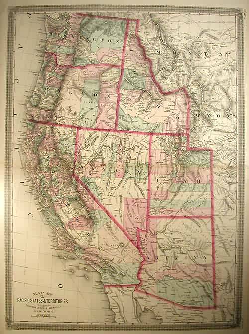
Map of the Pacific States & Territories
Out of stock
A very scarce large and decorative map, from a notable New York publishing team. Covering from border to border we see the western states hand colored by county with plenty of detail for development. Showing Washington, Idaho, Oregon, Utah, Nevada, California, and Arizona, specifying topography, hydrography, railroads, forts, small towns and major cities, this is an uncommon perspective of the Western US. With surrounding decorative border and very good condition, this is a great find for any collector or first time buyer.
Size: 20 x 27.5 inches
Condition: very good
Map Maker: Taintor Bros. & Merrill
Coloring: full hand color
Year: circa 1874
Condition: very good
Map Maker: Taintor Bros. & Merrill
Coloring: full hand color
Year: circa 1874
Out of stock


