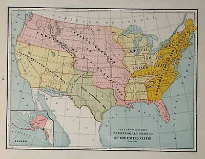
Map Showing the Territorial Growth of the United States 1776-1886
In stock
This map was made by George F. Cram in 1883 for “Crams Unrivaled Family Atlas”. The territorial acquisitions of the United States between 1776 and 1886 are illustrated on this map. An inset shows the Russian Cession (Alaska.
Size: 12 x 9 inches
Condition: Very Good- age toning
Map Maker: George F. Cram
Coloring: Printed Color
Year: 1883
Condition: Very Good- age toning
Map Maker: George F. Cram
Coloring: Printed Color
Year: 1883
In stock


