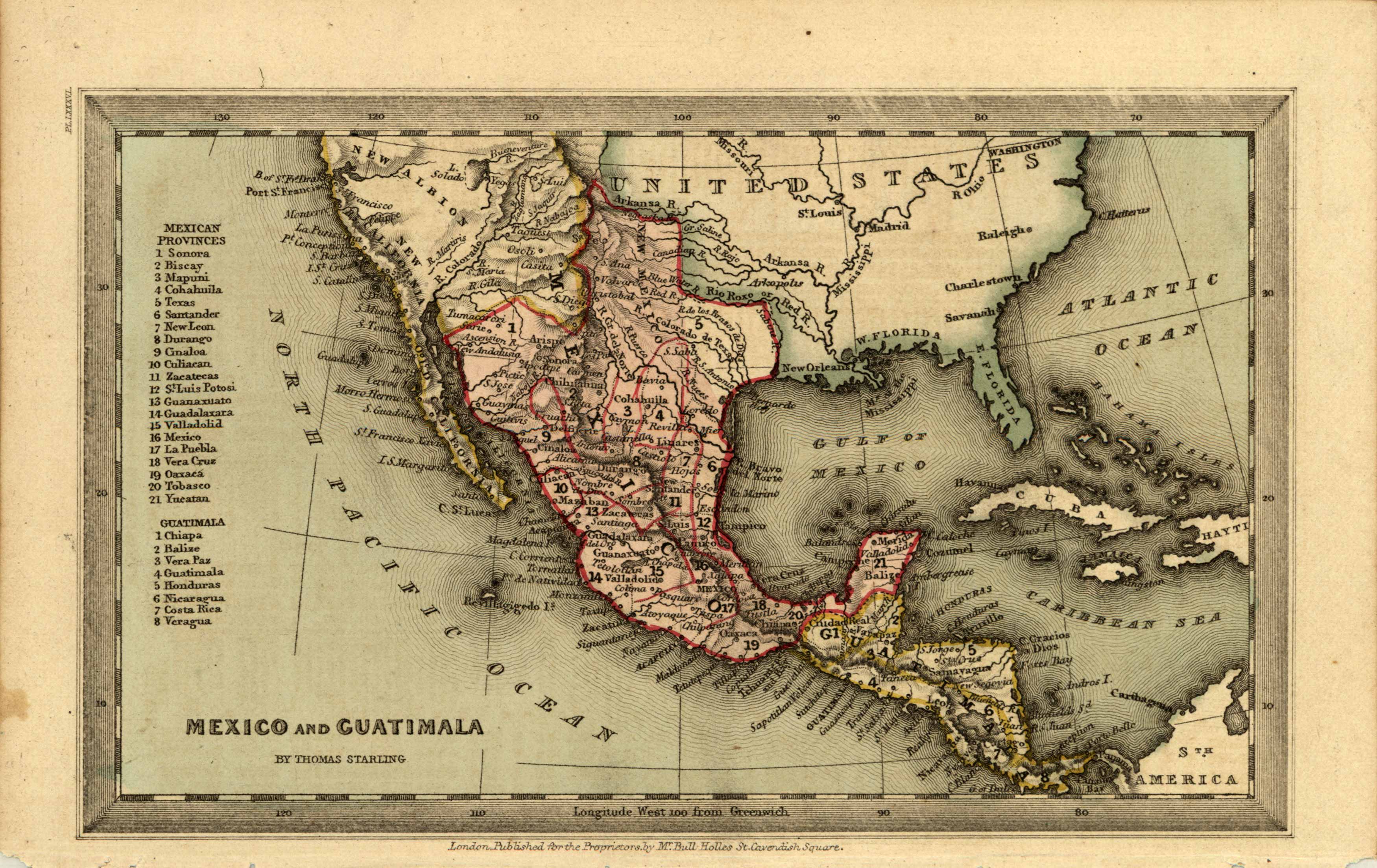
Mexico and Guatimala
In stock
This stunning miniature map of Mexico and Guatimala was issued in conjunction with “The Geographical Annual of Family Cabinet Atlas” specially patronized by their Most Gracious Majestys, William IV and Adelaide in 1833. Early Texas is shown. To encourage settlement, Mexican authorities allowed organized immigration from the United States, and by 1834, over 30,000 Angelos lived in Texas compared to 7800 Mexicans. Texas is called New Mexico. This atlas was issued as a “gift annual,” the traditional New Year present in Great Britain which usually took the form of a book of poetry or other illustrated volumes. Countries or regions are separated by colored sections. Rivers, lakes, cities, and land contours are indicated. The Mexican Provinces are numbered and listed.
Condition: Very Good
Map Maker: Thomas Starling
Coloring: Hand Colored, Steel Engraving
Year: 1833
In stock


