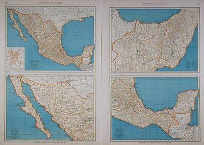
Popular Map of Mexico
In stock
The 1936, sixty-seventh edition of the “Rand McNally Commercial Atlas and Marketing Guide” is unique in its inclusion of informative details concerning population sizes, district uses, the size of counties, and railroad routes. Four views of Mexico (the entire country, the western section, central part and eastern section) is illustrated on these maps. The names of states, counties, important towns, lakes, rivers and mountain ranges are labeled.
Size: 12.5 x 18.5 inches
Condition: Very Good-age toning, small tears in margin
Map Maker: Rand McNally & Co.
Coloring: Machine Color
Year: 1936
Condition: Very Good-age toning, small tears in margin
Map Maker: Rand McNally & Co.
Coloring: Machine Color
Year: 1936
In stock


