 |
||
Military Topographical and Geographical Surveys West of the Mississippi
Out of stock
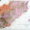
This map, made in 1879 for the U.S. Military Topographical and Geological Surveys, illustrates the topographical features of the United States west of the Mississippi River. Indian reservations, the names of states, territories, important cities, lakes, rivers, and mountains are shown.
Size: 44.5 x 32.5 inches
Condition: Good- age toning, minor paper loss in margin, small tears in margin, paper loss at folds
Map Maker: U.S. Military
Coloring: Machine Color
Year: 1879
Condition: Good- age toning, minor paper loss in margin, small tears in margin, paper loss at folds
Map Maker: U.S. Military
Coloring: Machine Color
Year: 1879
Out of stock