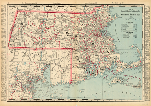
New Commercial Railroad and County Map of Massachusetts and Rhode Island
In stock
This double-page colorful map came from Crams 1895 Standard American Railway System Atlas of the World. In 1869 the George F. Cram Company was born and the Cram name quickly became synonymous with accuracy and innovation. This map shows all cities and towns, post offices, rivers, mountains, roads, and railroads. Each particular county is labeled and outlined. If you live in this area it is interesting to see how the boundaries have changed from a century ago.
Size: 25 x 17 inches
Condition: Excellent
Map Maker: George F. Cram
Coloring: Printed Color
Year: 1895
Condition: Excellent
Map Maker: George F. Cram
Coloring: Printed Color
Year: 1895
In stock


