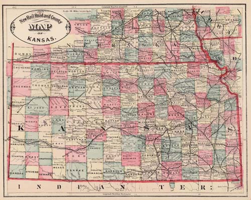
New Rail Road and County Map of Kansas
In stock
We believe that this map, issued as part of “Crams Illustrated Family Atlas of the World,” is the earliest hand colored atlas map produced by George Cram. There have only been a small number of these maps offered for sale over the last 30 years. This is a truly “rare” Cram map.
Size: 11.5 x 9.5 inches
Condition: Very Good with 3 small worm holes in margin and 1 in image
Map Maker: George F. Cram
Coloring: Original Hand Color
Year: 1882
Condition: Very Good with 3 small worm holes in margin and 1 in image
Map Maker: George F. Cram
Coloring: Original Hand Color
Year: 1882
In stock


