 |
||
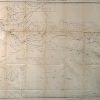
Part of Central Wyoming
Out of stock
This map was made by F.V.Hayden for the U.S. Geological and Geographical Survey in 1877. This topographical map illustrates part of Central Wyoming. Topography, important landforms, mountain ranges, rivers, and major roads are shown.
Size: 33 x 22.5 inches
Condition: Very Good- age toning, minor paper loss at folds
Map Maker: F.V. Hayden
Coloring: Black and White
Year: 1877
Condition: Very Good- age toning, minor paper loss at folds
Map Maker: F.V. Hayden
Coloring: Black and White
Year: 1877
Out of stock