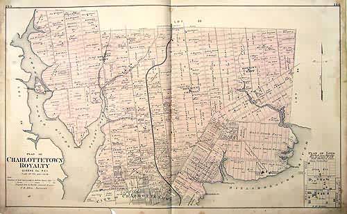
Plan of Charlottetown Royalty
Out of stock
This map is from the “Illustrated Historical Atlas of the Province of Prince Edward Island,” published in 1880 by J. H. Meacham and Company. These highly detailed maps show the names of streets and roads, rivers and lakes, railroads, important land owners, and even the location of some buildings. These extremely difficult to find maps would make a great addition to any collection.
Size: 25 x 16 inches
Condition: Good - minor tears, age toning
Map Maker: J. H. Meacham and Company
Coloring: Original Hand Coloring
Year: 1880
Condition: Good - minor tears, age toning
Map Maker: J. H. Meacham and Company
Coloring: Original Hand Coloring
Year: 1880
Out of stock


