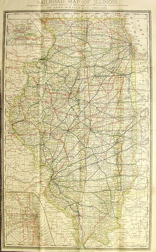
Railroad Map of Illinois Prepared for the 1882 Report of Railroad and Warehouse Commissioners
Out of stock
Dramatically portraying the importance of the rail lines, this map helps untangle the spaghetti-like railways that were filling the states at this time. In Illinois, hardly without exception all counties were serviced by at least one rail company and most were intersected with several rail lines. Fortunately, this map was color-coded and individually labeled for each railroad line throughout the state, and managed to contain very specific detail for small towns and burghs. This offers us an astounding amount of information for the entire state, while remaining clear and legible. Insets for the Chicago area, and another for Davenport & Rock Island give us the incite into how the lines are managed in the urban centers. Condition is very good with some minor repairs on opening fold.
Condition: Very Good - left margin trimmed close
Map Maker: Rand McNally
Coloring: Lithographic Color
Year: 1882
Out of stock


