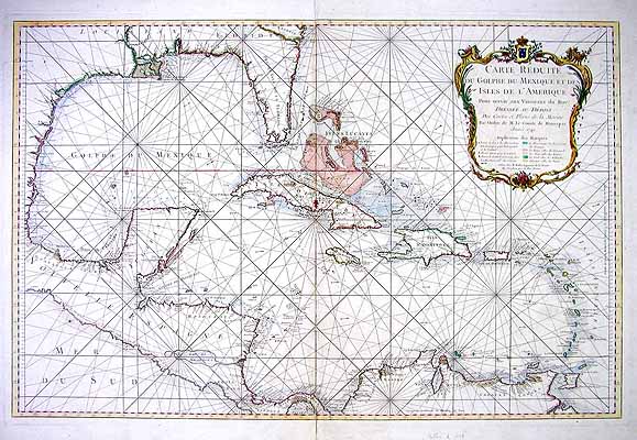
Carte Reduite du Golphe du Mexique st des Isles de LAmerique’
In stock
Jaques Nicolas Bellin made this map of the West Indies, titled “Carte Reduite Du Golphe du Mexique et Des Isiles de L”Amerique”, in 1749. This very large French map has pink, turquoise and yellow outline color of the islands and the coasts of Central and North America. The large cartouche is mostly gold with pink, green, and blue accents. It contains both the title and key. Some depth readings are provided, as well as forts, a road on Cuba, and many place names.
Size: 32.75 x 21.25 inches
Condition: Very Good-age toning, repaired splits at fold and at edge of margin
Map Maker: Jaques Nicolas Bellin
Coloring: Original Hand Color
Year: 1749
Condition: Very Good-age toning, repaired splits at fold and at edge of margin
Map Maker: Jaques Nicolas Bellin
Coloring: Original Hand Color
Year: 1749
In stock


