|
||
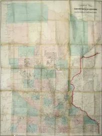
Central Colorado
Out of stock
This topographical map of part of central Colorado was made in 1876 under the direction of 1st Lieut. Wheeler of the U.S. Corps of Engineers. The map shows the vicinities of Pueblo and Colorado Springs, as far west as Eleven Mile Canyon.
Condition: Very Good-age toning, minor foxing in margin
Map Maker: U.S. Corps of Engineers, Lieut. Wheeler
Coloring: Machine Color (Black and Brown)
Year: 1876
Map Maker: U.S. Corps of Engineers, Lieut. Wheeler
Coloring: Machine Color (Black and Brown)
Year: 1876
Out of stock