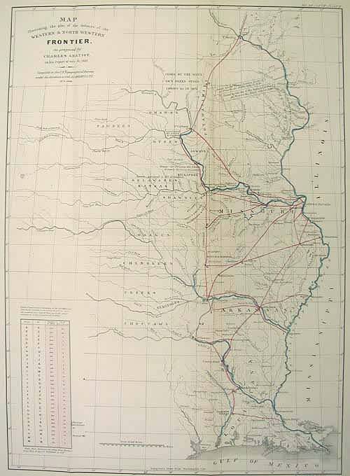
Map Illustrating the plan of the defences of the Western & North Western Frontier, as proposed by Charles Gratiot, in his report of Oct.31, 1837, western exploration
Out of stock
This map is interesting as it shows how the US began to work its way across the continent incrementally. Here we see Charles Gratiots proposal of a network of forts and towns that would help in the process of settling and establishing presence in these Indian territories and states just west of the Mississippi River. The range is quite large, spanning from Fort Snelling in present day Minnesota down to Fort Jessup in present day Louisiana. Included is a chart showing the distance and days march from one fort to the next. Numerous Indian tribes are cited along with their allotted territory. A fascinating detail of American expansion. Condition is good, with some supportive repairs. Original hand color has remained bold.
Map Maker: US Govt.
Coloring: Outline hand color
Year: 1861
Out of stock


