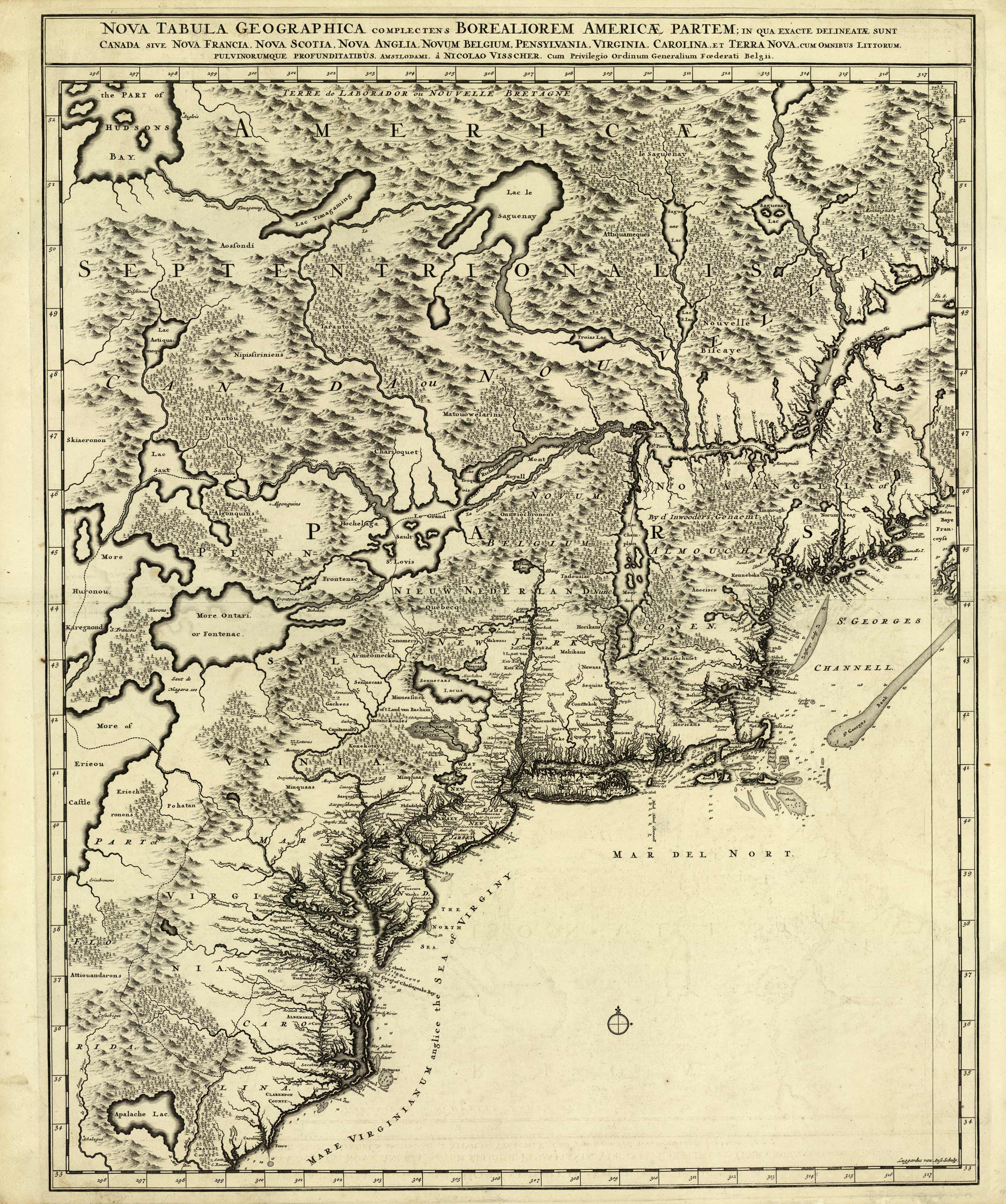
Nova Tabula Geograhica complectens Borealiorem Americae Partem
In stock
A highly detailed map of the coastline extending from the present-day Carolinas to New England. This map represents the second state of Nicolaes Visscher’s impressive two-sheet (this is only sheet 1) depiction of northeastern North America, which is believed to have first published around 1685. It spans a vast region, beginning with Newfoundland and the Grand Banks in the north and going down to the Carolinas and the speculative Lake Apalache in Spanish Florida. Among Dutch atlas maps created before 1700, it stands out as one of the largest and most detailed renderings of this part of the continent. This map has so many amazing details to note – including the Lac St. Pierre and Lac Champlain (Lake Champlain) and the large Sennecaas Lac (Seneca Lake) in New York. This map has incredible details related to indigenous tribes and the original identifications of so many New England towns and states.
Condition: Excellent
Map Maker: Nicolas Visscher
Coloring: Black & White
Year: 1696
In stock


