|
||
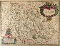
Occidentalis Americae parties�.
Out of stock
From Americae Pars Quarta Insignis & Admiranda Historia Engraved to accompany the fourth part of Theodore de Bry’s Grand Voyages, this map centers on the Caribbean main. Girolamo Benzoni, the author of the account, traveled between the years 1541 and 1556 in these waters. Born in Milan, he made his way to the New World by working aboard ship. He witnessed many Spanish cruelties to the Indians with whom he seems to have had some sympathy. The book is full of illustrations of these incidents. The beautifully engraved map shows the disproportionately sized islands of West Indies. The Florida peninsula is derived from that of le Moyne, 1591. However, since Benzoni’s voyage pre-dates the French expeditions there, we find no reference to them. The Bahaman islands of Bahama and LVCAYA are placed too far north. It was included in further Latin editions in 1594 and 1634, also a later German one of 1613. This map shows much detail including cities and towns, regions, lakes and rivers, mountains and forested areas. Includes ornate sailing ships, sea monsters, compass roses and a beautiful cartouche in the upper right corner.
Map Maker: Theodore de Bry --- Girolamo Benzoni
Coloring: Black and White
Year: 1594
Out of stock