Rand McNally Official Railroad & Land Survey Map of the United States & Southern Canada
Out of stock
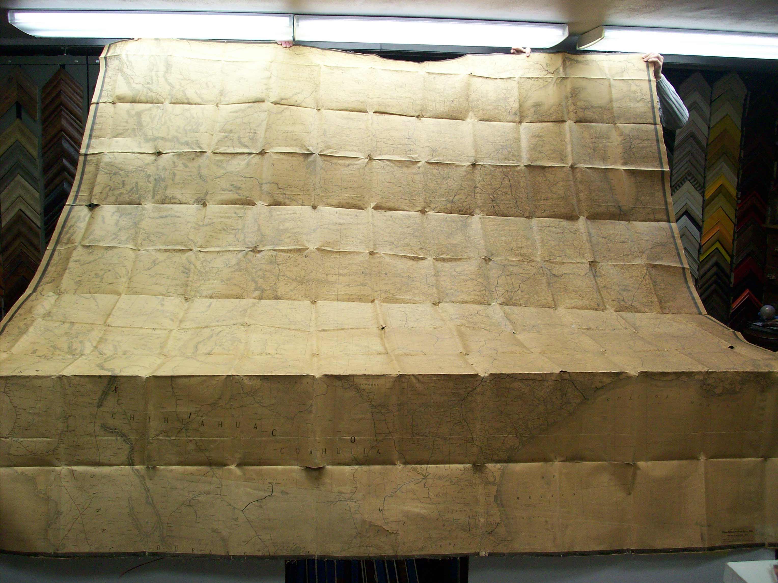
This is an incredible, extremely large & rare antique map of part of the United States, done in 1919. If you have a huge wall in your home or office and want a statement piece, than this map is perfect for you! It measures 110 inches tall by 104 inches wide. Thats over 9 x 9 feet! It’s titled, “The Rand-McNally Official Railroad & Land Survey Map of the United States & Southern Canada.” The scale is 15 miles to 1 inch. It’s dated December of 1919. The map includes South Texas, up north to the Canadian border, west to Idaho and east to Tennessee.
Condition: Good - paper loss, cracking & fading
Map Maker: Rand McNally
Coloring: Hand Colored
Year: 1919
Map Maker: Rand McNally
Coloring: Hand Colored
Year: 1919
Out of stock


