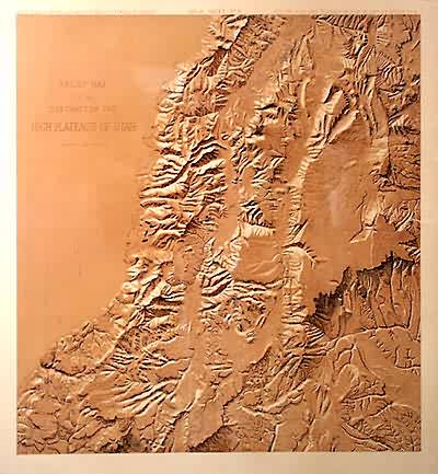
Relief Map of the District of the High Plateaus of Utah
Out of stock
This relief map illustrated the high plateau region of Utah. It was made in 1879 for the U.S. Geography and Geology Survey.
Size: 20.25 x 22 inches
Condition: Good- age toning, small tears at margin
Map Maker: Capt. C.F.Dutton, Department of the Interior
Coloring: Machine Color
Year: 1879
Condition: Good- age toning, small tears at margin
Map Maker: Capt. C.F.Dutton, Department of the Interior
Coloring: Machine Color
Year: 1879
Out of stock


