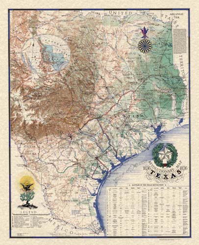
Sesquicentennial Map of Texas 1836-1986 (Texas Revolution 1835-1836)
This sesquicentennial map of Texas illustrates the revolutionary time between 1835 and 1836. Colony boundaries, trails, correct town locations, battle sites, and many other details make this map unique to this period. This map also includes a key showing many details of the battles of the Texas Revolution. Compiled by John Davis and hand drawn to exacting specifications by Richard Hubbard, the map’s data is formatted onto specially prepared physiographic base drawing. The Indian, French, Spanish, Mexican, Anglo colonists, and United States’ influences are noted throughout the work in the unique calligraphic style of Sharon Roos. Roos and Hubbard worked together to produce the inset map of the Republic of Texas, sourcing an 1849 De Cordova map inset, showing Texas as a territory that stretched the length of the United States. The Texas Sesquicentennial Map is a great addition to Texans and map/history enthusiasts.
Map Maker: John Davis, Richard Alan Hubbard, and Sharon L. Roos
Original Production Year: 1836


