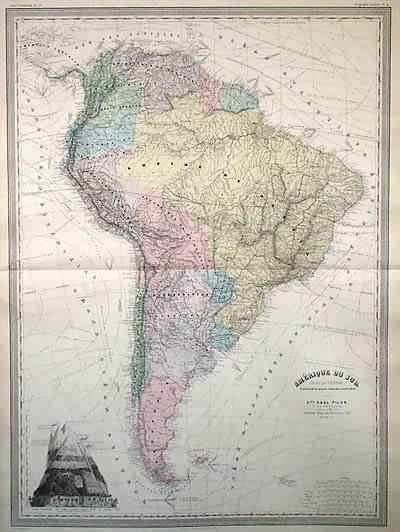
Amerique du Sud (SOUTH AMERICA)
In stock
Exceptionally large, detailed steel-plate map, in French, of South America in the mid-1800s. Excellent detail of mountains and rivers, as well as nautical information. Gives information on currents, winds, sea ice, and major shipping routes. Diagram at bottom left gives heights of highest mountains, as well as the vegetation zones at different elevations.
Size: 21.5 x 29.5 inches
Condition: Very Good: overall age toning, edges brittle
Map Maker: A.H. Dufour, Grand Atlas Universel
Coloring: Original hand color
Year: 1860
Condition: Very Good: overall age toning, edges brittle
Map Maker: A.H. Dufour, Grand Atlas Universel
Coloring: Original hand color
Year: 1860
In stock


