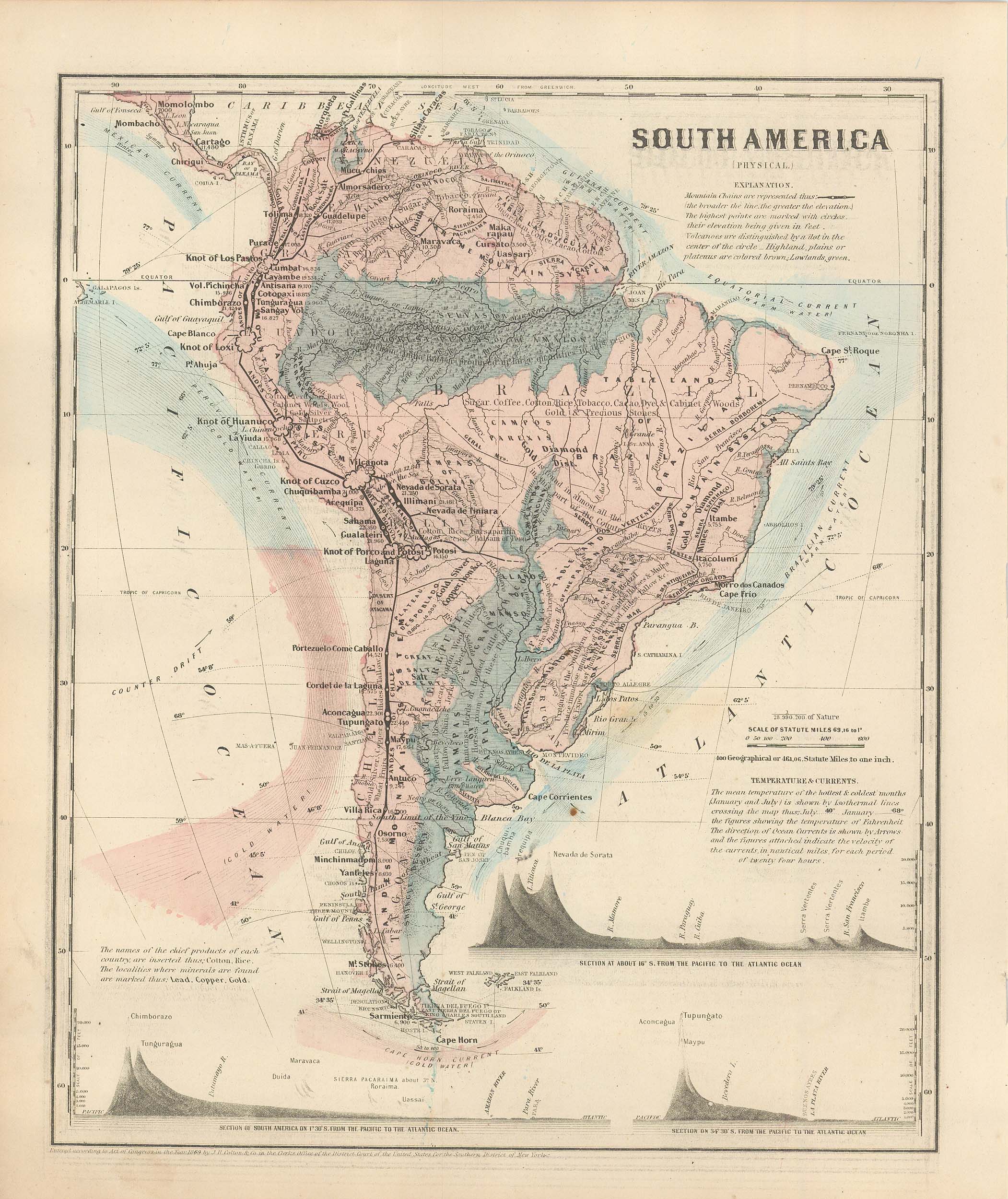
Colton’s 1860 Physical Map of South America
In stock
This physical map was issued as part of J.H. Colton’s 1860 School Atlas. This map shows the height of mountains in a unique graph form. Mountain ranges, volcanoes, table lands, and plateaus are denoted. The mean temperatures at midwinter and midsummer are shown as well as the direction of ocean currents. We consider Colton to be the premier mapmaker in American History. His maps are known for their precision and attention to detail.
Size: 9.75 x 12 inches
Condition: Very Good
Map Maker: J.H. Colton
Coloring: Hand-Colored Steel Engraving
Year: 1860
Condition: Very Good
Map Maker: J.H. Colton
Coloring: Hand-Colored Steel Engraving
Year: 1860
In stock


