Texas
In stock
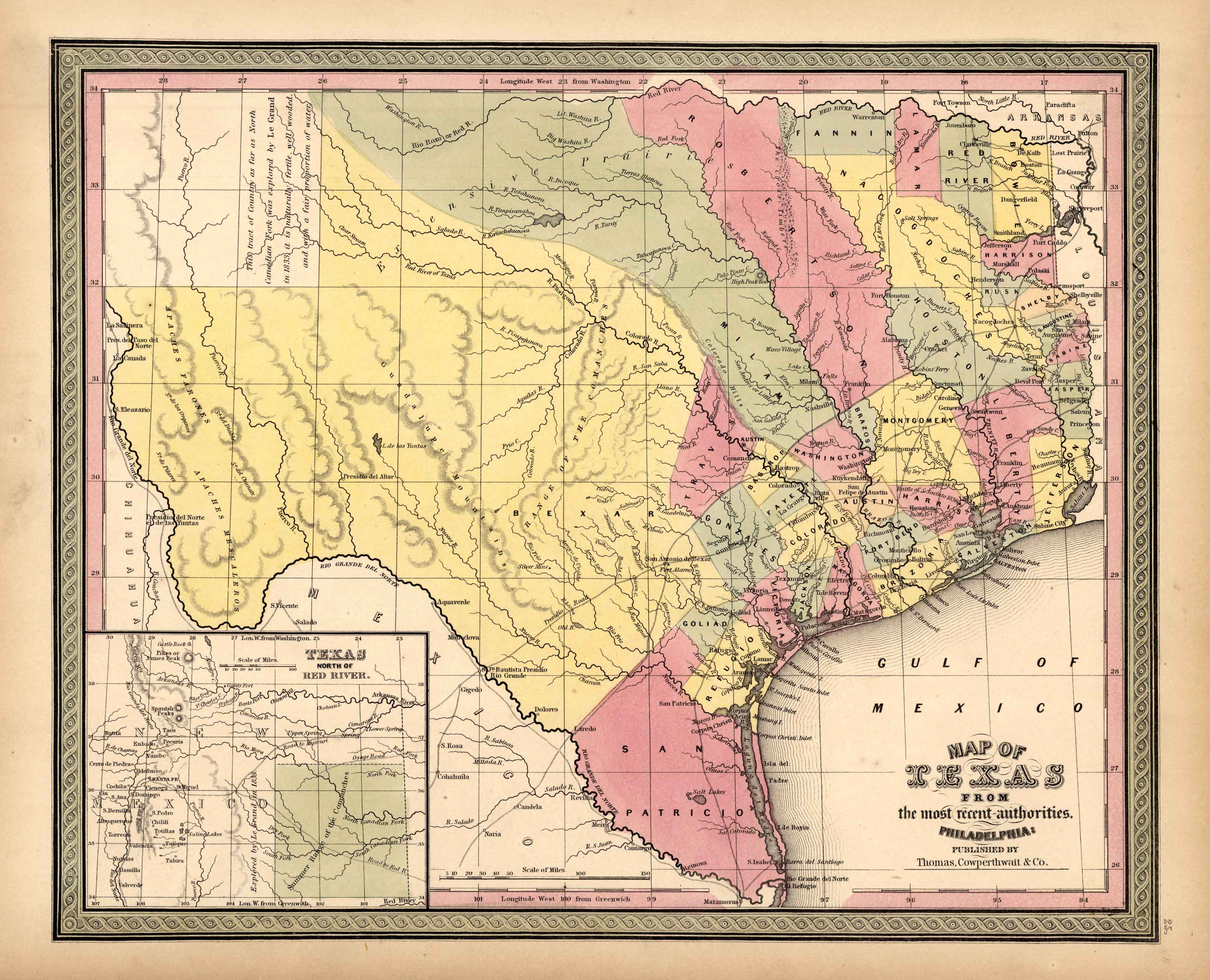
We are privileged to offer this map of Texas, issued as part of S. Augustus Mitchells New Universal Atlas of 1851. Mitchell, one of America’s premier mapmakers, published this atlas from 1846-1849. In 1850, Thomas, Cowperthwait and Co. purchased the copyright for this atlas. He enlarged the atlas to include more maps and also added the new features of a chromolithographed title page and contents page. The lithographed maps issued by Cowperthwait and Co. are what we consider the finest maps produced in this era of mapmaking. One of the reasons that these maps by Cowperthwait are exceptionally difficult to find is because of their short period of publication from 1850-1854. The copyrights on some of these maps show Mitchell or Cowperthwait’s name. This handsome map of the young state of Texas is one of the most influential atlas maps of the period. This map of Texas is extremely unique in that it shows large, undivided counties stretching to the new frontier of Texas. Bexar, Milam & Robertson counties extend extremely far into the north and west. Also of interest is the delineation of the Mescalero Apache Indian tribe in the Panhandle and the ‘Range of the Comanches.’ In the far western corner, the map mentions the Le Grand exploration in 1833 describing the land as ‘naturally fertile, well wooded and with a fair proportion of water.
Condition: Very Good, light age toning
Map Maker: Thomas, Cowperthwait and Co.
Coloring: Lithography with Hand Color
Year: 1851
In stock


