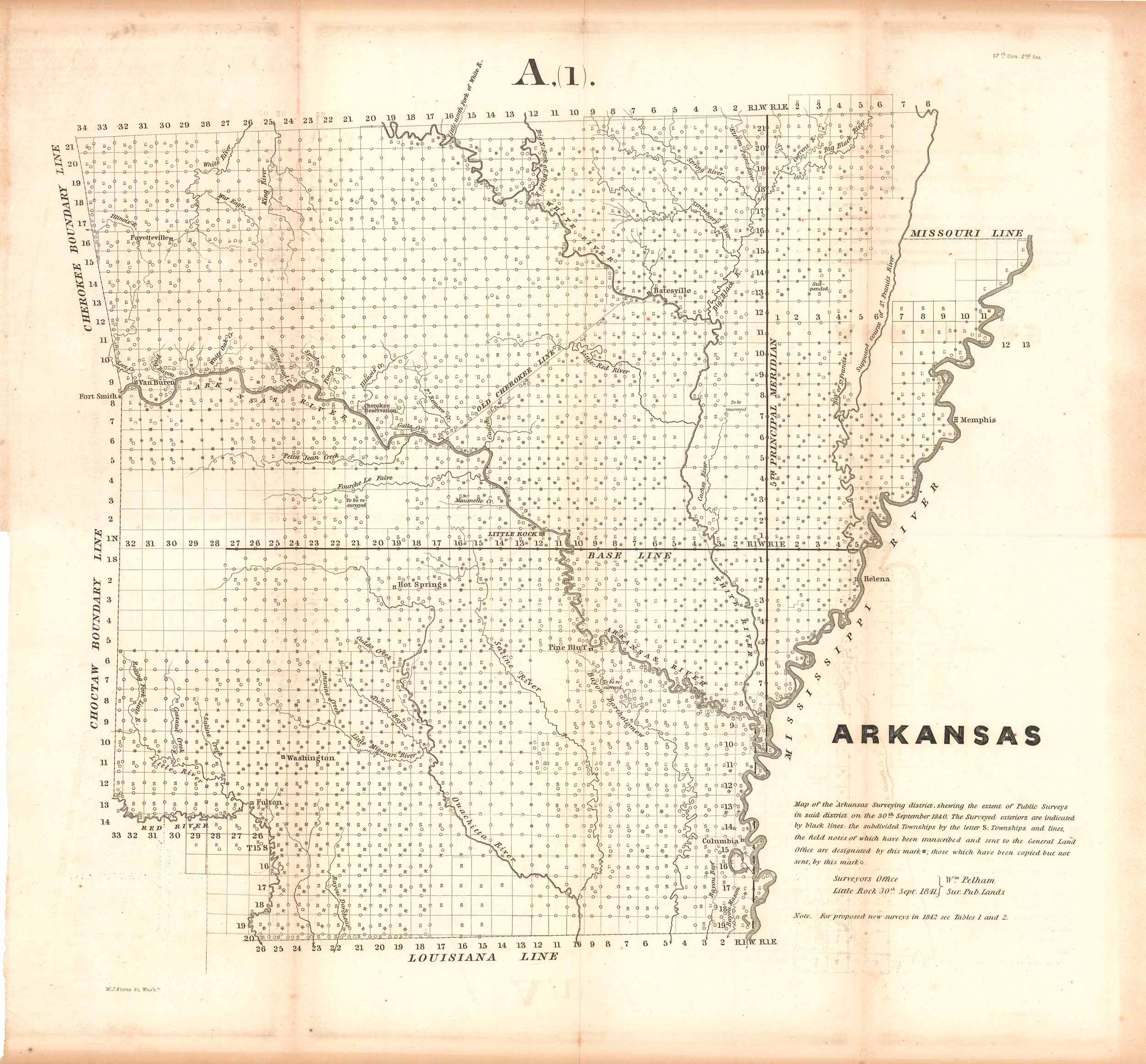
Map of Arkansas Surveying District, 1840
Out of stock
This is a map of the Arkansas Surveying District showing the extent of public surveys in said district on the 30th September, 1840. This surveyors map also showcases townships and lines, the field notes of which have been sent to the General Land Office, and are designated by distinct marks that are explained in the notes. On this map you will also find the Arkansas River, Choctaw Boundary Line, Old Cherokee Line, Cherokee Reservation, Little Red River, Batesville, Mississippi River, Louisiana Line, Little Rock and more.
Size: 16 x 14.25 inches
Condition: Very good
Original Production Year: 1840
Coloring: Black & White
Year: 1840
Condition: Very good
Original Production Year: 1840
Coloring: Black & White
Year: 1840
Out of stock


