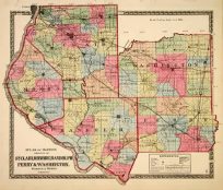
County Map of California – Map of Settlements in the Great Salt Lake Country, Utah
In stock
This hand colored map was made by S. Augustus Mitchell, Jr. for “Mitchells New General Atlas” in 1868. California is illustrated on the main map with an inset of San Francisco Bay and Vicinity. The smaller map on the page shows settlements in Utah. Counties and settlements are differentiated by color. Other details include the names of counties, settlements, and important cities. Illustrations of rivers, lakes, major roads, and mountains are provided. This atlas has very beautiful coloring-more muted than typical.
Size: 11 x 13 inches
Condition: Very Good
Map Maker: S. Augustus Mitchell
Coloring: Original Hand Color
Year: 1868
Condition: Very Good
Map Maker: S. Augustus Mitchell
Coloring: Original Hand Color
Year: 1868
In stock


