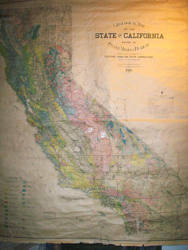
Geological Map of the State of California
Out of stock
Issued by the State Mining Bureau, compiled under the direction of Fletcher Hamilton, State Mineralogist, published in 1916, this wall map is a beautiful colored state of California indicating the geological soil classifications. Perfect for any soil and rock and stratum enthusiast! The colored sections indicate the geological ages of rock and soil including: Tertiary, Cretaceous, Jurassic, Paleozoic, and Igneous rocks. Other markings include county boundaries, county seat towns, railways, highways, roads, electric transmission lines, oil and pipe lines, springs and wells. This map is hung from a wooden dowel at the top. It is in good condition with natural wear and tear and age toning, some paper loss and cracks throughout. Additional pictures available. Appx. size: 59.5″ x 49.5″, with an 1.5″ border.
Condition: Good, some age toning, cracks, and paper loss
Map Maker: State Mining Bureau
Coloring: Printed Color
Year: 1916
Out of stock


