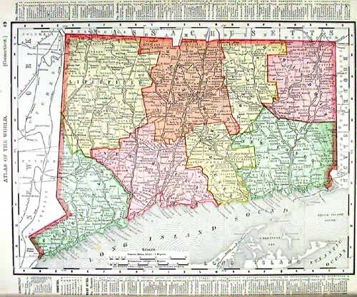
Connecticut
In stock
This detailed map was originally published in Rand, McNally & Co.s Universal Atlas of The World. From its beginnings as a small Chicago printing shop in 1856, Rand McNally & Company launched a 146-year continuing journey that has led the company to its place as the world’s premier provider of geographic and travel information. This colorful map was published at the turn of the century in 1902. This map shows cities and towns, lakes and rivers, and the existing railroad network. Also note the information in the margin of the state maps which details land and water area, population broken down by gender and ethnic group, and the population of major towns and counties. City maps show the location of major streets and roads, as well as points of interest.
Condition: Very Good
Map Maker: Rand, McNally & Co.
Coloring: Lithographic Coloring
Year: 1902
In stock


