State of Florida
In stock
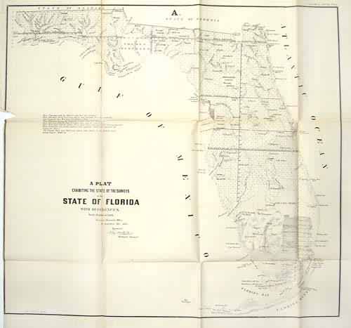
The 1855 Florida GLO map was divided into 3 sections, showing North, South, and Western Florida. The western portion covers the land between the Perdido and Oclocknee Rivers, with good river detail and survey coverage in the west. The northern map covers land between the Wacilla River and the Atlantic Ocean, south to Lake George. This area includes the Arredondo Grant, Jacksonville, and Newmanville. The southern sheet covers the rest of the state south of Lake George, much of which is everglades and marked as swampland. The Line of the 20 Mile Indian Reserve is marked, also the military reserve on Hillsborough Bay and Fort Izard and Smyrna. Title and references are on the western sheet only.
Size: 25 x 22 inches
Condition: Good - minor foxing, and browning in folds, achival repairs to some folds
Map Maker: General Land Office
Coloring: Black & White
Year: 1855
Condition: Good - minor foxing, and browning in folds, achival repairs to some folds
Map Maker: General Land Office
Coloring: Black & White
Year: 1855
In stock


