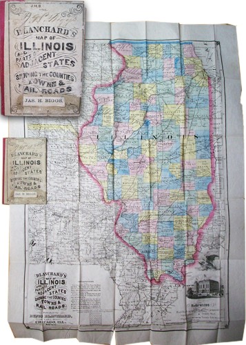
Blanchards Map of Illinois and Parts of Adjacent States, Showing the Counties, Towns & Railroads’
In stock
This extremely rare pocket map was published in 1866 by Rufus Blanchard. Rufus Blanchard was one of the most well known map publishers in Chicago during the late nineteenth century. Blanchard was born in New England and his first job was a hunter & trapper in the Ohio wilderness. In 1849, Blanchard returned to New York and began his career in the map publication business with C. Morse, son of Samuel Morse, inventor of the telegraph. In 1854, he opened his map store in Chicago where he specialized in mapmaking, publishing as well as writing histories of Chicago, Cook County, and the Northwest Territories. Blanchard published the first of his many street guides in 1857 and continued to produce quality maps until his death in 1904. In 1867, Blanchard went into business with his 25 year old nephew, George F. Cram. The George F. Cram company is still a leader in the industry of maps and globes. This is a stunning, hand colored map of Illinois. It has 2 black & white illustrations of the Bald Eagle and the Chamber of Commerce building in Chicago. It also shows parts of Iowa and Missouri in great detail. Its in very good condition, with only one minor paper tear on the bottom border, as well as some minor paper loss in some of the folds.
Condition: Very Good, Archivally Repaired Tear at Bottom
Map Maker: Rufus Blanchard
Coloring: Hand Colored
Year: 1866
In stock


