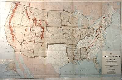
Map of the United States and Territories
Out of stock
This map of the United States was made in 1885 by the General Land Office. Details include the names of territories, states, and important cities, rivers, lakes, and mountains. The Indian Territory which became Oklahoma is identified, to its north-west is a piece of land identified as “Public Land”, Dakota was not yet seperated into two states, and the borders of several states have since changed. An inset shows Alaska at a smaller scale.
Size: 38 x 24 inches
Condition: Very Good- age toning, minor paper loss at folds,
Map Maker: General Land Office
Coloring: Machine Color
Year: 1885
Condition: Very Good- age toning, minor paper loss at folds,
Map Maker: General Land Office
Coloring: Machine Color
Year: 1885
Out of stock


