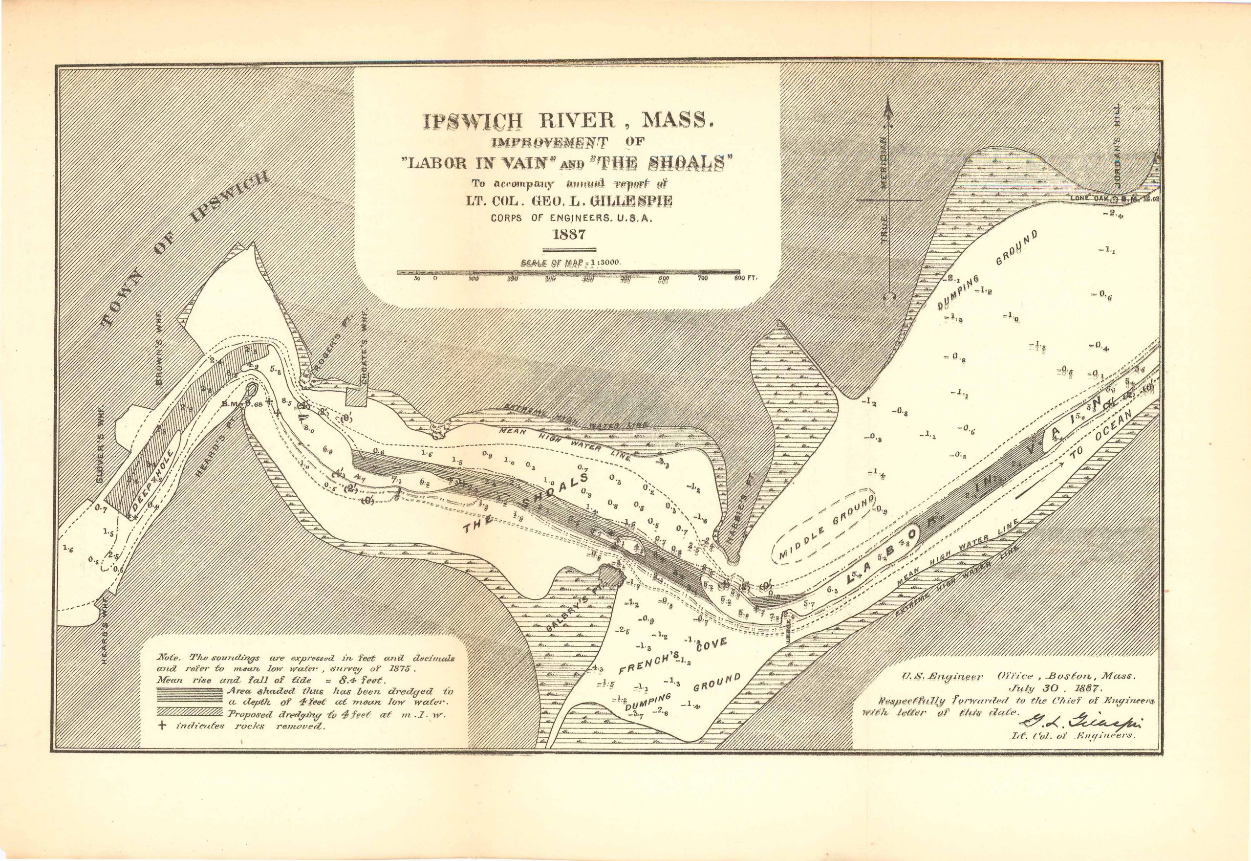
Ipswich River, Mass. Improvement of “Labor in Vein” and “The Shoals” 1887
In stock
Ipswich River, Mass. Improvement of “Labor in Vein” & “The Shoals”; to accompany annual report of L.T. Col. Geo. L. Gillespie Corps of Engineers, U.S.A. This map is on a scale of 1:3000 and comes with a note that reads: “The soundings are expressed in feet and decimals and refer to mean low water, survey of 1875. Mean rise and fall of tide = 8.4ft” and indicates what the various markings mean on the map. Also featured is Heard’s Point, Rodger’s Point, Jordan’s Hill, Galbry’s Point, and French’s Cove.
Size: 11.5 x 7.25 inches
Condition: Very good
Map Maker: U.S. Corps of Engineers
Original Production Year: 1887
Coloring: Black & White
Year: 1887
Condition: Very good
Map Maker: U.S. Corps of Engineers
Original Production Year: 1887
Coloring: Black & White
Year: 1887
In stock


