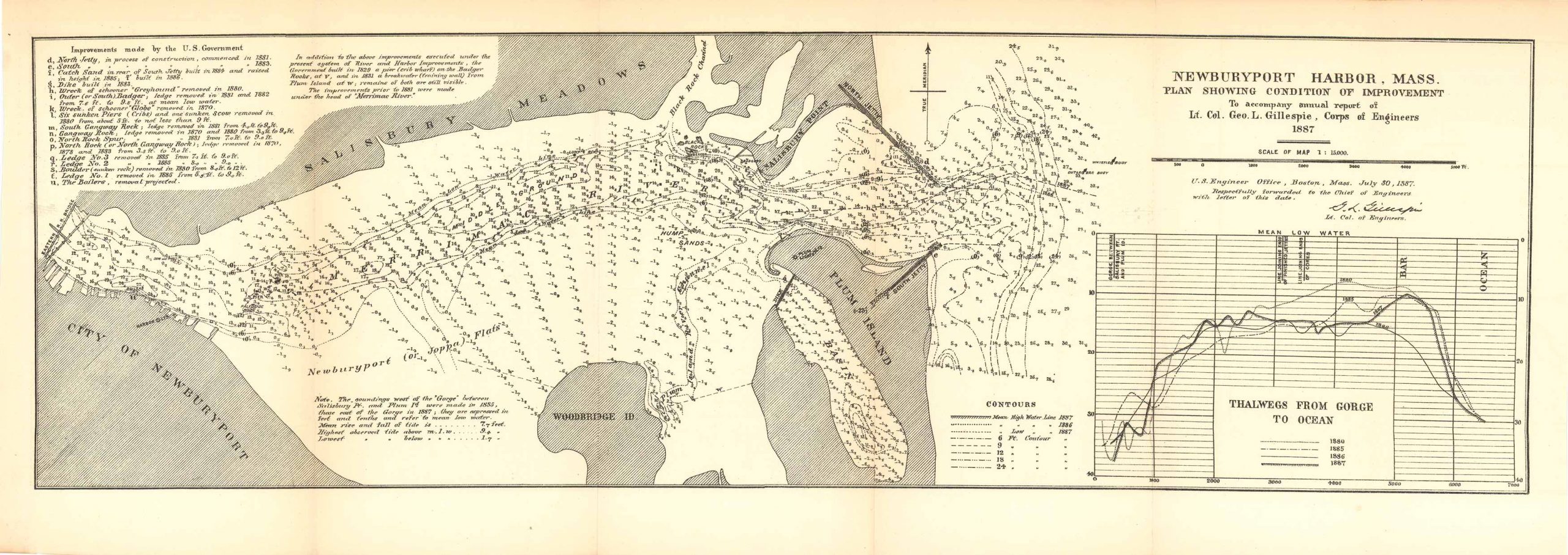
Map of Newburyport Harbor, Massachusetts; Plan Showing Condition of Improvement 1887
In stock
This is a map of Newburyport Harbor Massachusetts, on the Plan Showing Condition of Improvement to accompany the annual report of Lieutenant Colonel Geo. L. Gillespie, Corps of Engineers 1887. Drawn up by the U.S. Engineer Office in Boston, Mass. on July 30th, 1887 and respectfully forwarded to the chief of Engineers. This map is on a scale of 1:15000 and features an inset chart of the Thalwegs from Gorge to Ocean. Also featured is a small key indicating the meanings of various lines and soundings, a list-style note in the upper left hand corner listing the Improvements made by the U.S. Government, and other features such as: The City of Newburyport, Woodbridge, Plum Island, Salisbury Meadows, Salisbury Point, Joppa Flats, the Merrimac River among a few others.
Condition: Very good
Map Maker: U.S. Corps of Engineers
Original Production Year: 1887
Coloring: Black & White
Year: 1887
In stock


