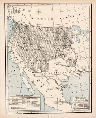
Expansion of the US from the Mississippi River to the Pacific Coast
In stock
George F. Cram produced this historical map of the western expansion of the United States for Crams Unrivaled Atlas of the World in 1889. This map shows the US territorial growth from the Mississippi River to the Pacific Coastline. The annexation of Texas, Louisiana Purchase, and First Mexican Cession are featured on this map. Also included are two charts showing the Presidential Administrations from 1845-1861, and the states admitted into the Union between 1845 and 1859.
Size: 9.5 x 12.25 inches
Condition: Very Good
Map Maker: George F. Cram
Coloring: Printed Color
Year: 1889
Condition: Very Good
Map Maker: George F. Cram
Coloring: Printed Color
Year: 1889
In stock


