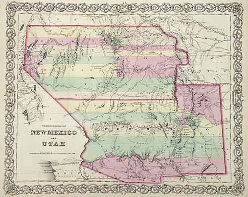
Territories of New Mexico and Utah
In stock
This maps importance is indicated by its use as the color frontispiece for volume 4 of Carl Wheat’s monumental “Mapping of the Transmississippi West”. The genuine attractiveness of the map and the large number that were printed guarantees it as a staple in the map trade. There is yet another reason for it’s appeal. The production of the map from 1855-1863 covers a remarkable period during which the enormous land area of the two territories was carved up to produce Nevada, Colorado, and Arizona in addition to New Mexico and Utah. In those eight years, successive printings of this map show significant changes, whereas most maps of the eastern states barely changed. This dramatic sequence makes the various states this map of New Mexico and Utah popular with many map collectors.This map is State #5 of this map. The first year “Arizona” appeared on a Colton map.Thank you to Wes Brown, founder of The Rocky Mountain Map Society, for extensive research on this Colton map….
Condition: Very Good
Map Maker: J.H. Colton & Co.
Coloring: Original Hand Coloring
Year: 1859
In stock


