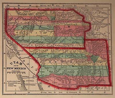
Utah & New Mexico
In stock
Art Source is proud to offer maps from the Diamond atlas by Samuel Gaston and Charles Morse. These are some of our favorite maps because of their small size. These maps are known for their bright water coloring that was in use during this time period. All maps are hand colored with steel engraving. The North East corner of New Mexico extends into present day Colorado and extends west occupying all of Arizona and part of Nevada. The border of Utah in this map extends west to the California border which is now Nevada. This map also notes unexplored territory, numerous Indian tribes, Freemonts route of 1844 and 1845, the Spanish Trial, and purposed railroad routes. This antique map is a classic example of the extensive development of the Western territories of the United States.
Condition: Very Good
Map Maker: Samuel N. Gaston & Charles W. Morse
Coloring: Original Hand Coloring
Year: 1857
In stock


