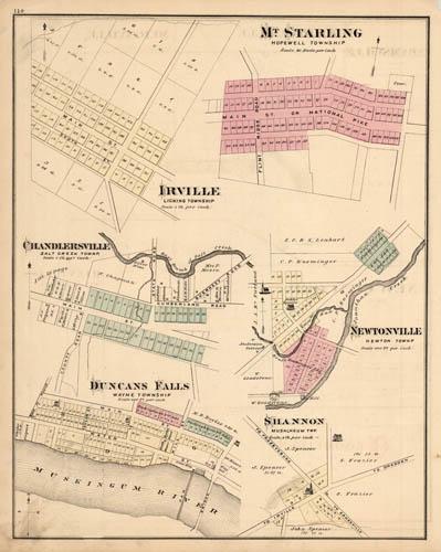
Mt. Starling, Hopewell Township. Irville, Licking Township. Chandlersville, Salt Creek Townp. Newtonville, Newton Townp. Duncans Falls, Wayne Township. Shannon, Muskingum TWP. (Ohio)
In stock
We are pleased to offer this lithographed map of Mt. Starling, Irville, Chandlersville, Newtonville, Duncans Falls, Shannon, Ohio. This map was issued in 1875 as part of the rare “Combination Atlas of Muskingum County, Ohio”, published by L.H. Everts & Co. Everts was one of the premier county atlas publishers in the United States. From his beginnings with the firm of Thompson and Everts (1865-1872) to the close of his career as proprietor of The Century Map Company (1902-1913), Louis Everts rode the wave of county map and atlas publishing and, indeed, influenced its course over the years.
Size: 12.75 x 16 inches
Condition: Very Good, light age toning and foxing
Map Maker: L.H. Everts & Co.
Coloring: Original Hand Color
Year: 1875
Condition: Very Good, light age toning and foxing
Map Maker: L.H. Everts & Co.
Coloring: Original Hand Color
Year: 1875
In stock


