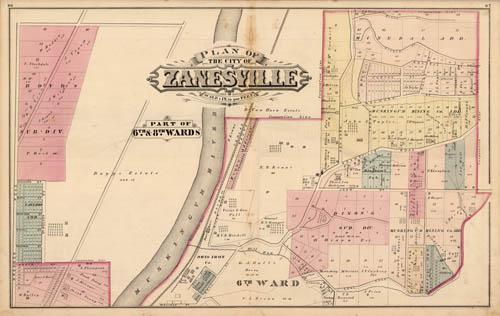
Plan of the City of Zanesville- Part of 6th & 8th Wards (Ohio)
In stock
We are pleased to offer this lithographed map of the plan of the city of Zanesville, Ohio (Part of 6th & 8th Wards). This map was issued in 1875 as part of the rare “Combination Atlas of Muskingum County, Ohio”, published by L.H. Everts & Co. Everts was one of the premier county atlas publishers in the United States. From his beginnings with the firm of Thompson and Everts (1865-1872) to the close of his career as proprietor of The Century Map Company (1902-1913), Louis Everts rode the wave of county map and atlas publishing and, indeed, influenced its course over the years.
Size: 26 x 16.25 inches
Condition: Very Good, light age toning and foxing
Map Maker: L.H. Everts & Co.
Coloring: Original Hand Color
Year: 1875
Condition: Very Good, light age toning and foxing
Map Maker: L.H. Everts & Co.
Coloring: Original Hand Color
Year: 1875
In stock


