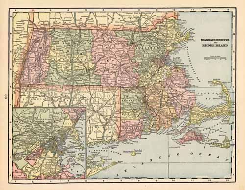
Massachusetts and Rhode Island
In stock
This colorful map came from Crams 1898 Universal Atlas – Geographical, Astronomical and Historical. In 1869 the George F. Cram Company was born and the Cram name quickly became synonymous with accuracy and innovation. This map of Massachusetts and Rhode Island shows the primary towns, rivers, mountains, roads, and railroads. Each particular county is labeled and colored. This map is a large scale, double page fold-out.
Size: 20 x 13.5 inches
Condition: Excellent
Map Maker: George F. Cram
Coloring: Machine Color
Year: 1898
Condition: Excellent
Map Maker: George F. Cram
Coloring: Machine Color
Year: 1898
In stock


