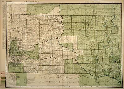
Standard Map of South Dakota
In stock
The 1936, sixty-seventh edition of the “Rand McNally Commercial Atlas and Marketing Guide” is unique in its inclusion of informative details concerning population sizes, district uses, the size of counties, and railroad routes. Cities and their populations are listed beside the map. Each map is brightly colored; predominantly in green with blue oceans, lakes and rivers, and brown coloring of high density metropolitan areas. South Dakota is illustrated on this large, double page map. The names of states, counties, important towns, lakes, rivers and mountain ranges are labeled.
Size: 26.75 x 19 inches
Condition: Very Good-age toning
Map Maker: Rand McNally
Coloring: Machine Color
Year: 1936
Condition: Very Good-age toning
Map Maker: Rand McNally
Coloring: Machine Color
Year: 1936
In stock


