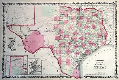
Johnsons New Map of the State of Texas
In stock
This antique map came from Johnsons New Illustrated (Steel Plate) Family Atlas, published in 1863, by Johnson and Ward. These maps are some of the most colorful andaccurate maps produced in the 1860’s. Johnson maps are characterized by hand coloring in red and green and distinctive borders, including iron scrollwork and a Celticdesign. This is a very interesting, historically significant map of Texas. This map has the pony express route outlined, along with the territories of El Paso andPresidio. This is an incredible chronicle of the westward expansion in that you can see clearly the westward movement and the vast amount of undiscovered territory.Above Texas, which is currently Oklahoma, there is unexplored territory belonging to the Indians. This map includes insets of plans of Sabine Lake, the Northern part ofTexas and Galveston Bay.
Condition: Very Good - age toning, some foxing
Map Maker: Johnson and Ward
Coloring: Original Hand Color
Year: 1863
In stock


