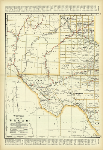
Western Half of Texas
In stock
We are proud to offer this map from George F. Crams 1902 Standard American Railroad System Atlas. This is possibly the last railway system atlas Cram published. With the exceptionally bright colors, and crisp, bright paper these maps are in excellent condition and are superior to other Cram railroad atlases. The maps main emphasis, however, must certainly be the precise depiction of the railroad routes. Every railroad line is named, numbered, and color-coded by a legend on the map, giving a detailed glimpse into the prolific rail-system of turn-of-the-century America. Cities, towns, lakes, rivers, creeks, and mountain ranges are shown, counties are outlined in pink, and railroad lines are given in yellow, red, blue, and green. A fine addition to any collection!’
Condition: Excellent
Map Maker: George F. Cram
Coloring: Printed Color
Year: 1902
In stock


