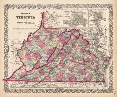
Virginia and West Virginia (with inset maps of Richmond, Henrico County, Manchester and Spring Hill, Chesterfield Co., and Norfolk, Portsmouth and Gosport)
In stock
Art Source International is proud to offer this map of Virginia and West Virginia (with inset maps of Richmond, Henrico County, Manchester and Spring Hill, Chesterfield Co., and Norfolk, Portsmouth and Gosport) from the 1866 edition of Coltons General Atlas. Colton atlases, especially those from the late 1860’s, have become increasingly difficult to find. This highly detailed map is distinguished by its hand coloring and signature 3/4″ border. Counties, cities and towns, railroads, and various geographic features are shown on this map.
Size: 16 x 13 inches
Condition: Very Good, light age toning
Map Maker: G.W. & C.B. Colton
Coloring: Original Hand Color
Year: 1866
Condition: Very Good, light age toning
Map Maker: G.W. & C.B. Colton
Coloring: Original Hand Color
Year: 1866
In stock


