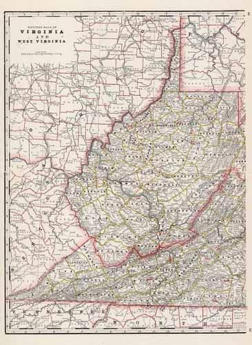
Western Half of Virginia and West Virginia
In stock
This map of the western half of Virginia and West Virginia was produced by the George F. Cram Company for his Standard American Atlas of the World in 1887. This atlas was a precursor to his impressive railroad atlases. In 1869 the George F. Cram Company was born and and the Cram name became synonymous with accuracy and innovation. This map shows all railroads, unfinished railroads, county seats, post offices, money order post offices, and large and small towns. This map is an early example of Crams large format maps and is impressive in its level of detail.
Size: 16.5 x 22 inches
Condition: Excellent
Map Maker: George F. Cram
Coloring: Printed Color
Year: 1887
Condition: Excellent
Map Maker: George F. Cram
Coloring: Printed Color
Year: 1887
In stock


