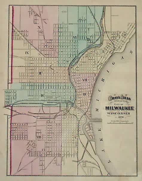
Grays Atlas Map of the City of Milwaukee Wisconsin’
In stock
Made for the 1873 “Grays Atlas of the United States with General Maps of the World ” by O.W. Gray, a Civil and Topographical Engineer. Bright pastel hand coloring, fine detailing and simple lined border complete the maps within this atlas. This city map shows streets, canals, and railroads.
Size: 12 x 14 inches
Condition: Very Good- some spotting along edges
Map Maker: O.W Gray
Coloring: Original Hand Coloring
Year: 1873
Condition: Very Good- some spotting along edges
Map Maker: O.W Gray
Coloring: Original Hand Coloring
Year: 1873
In stock


