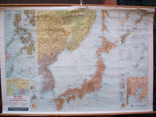
War Map of Japan and Other Strategic Pacific Areas
Out of stock
This large wall War Map of Japan was published by Standard Oil Company (NJ), probably in the mid to late 20th century. Legend indicates railroads, roads, tracks or trails, reefs, international boundaries, and provincial boundaries. This map includes several inset maps including: Philippine Islands with Manila & Vicinity, Palau Islands, Truk Islands, Canton-Hong Kong area, Dublon, Yap, Angaur, Paramushiru, Ryukyu Islands, Tokyo, and several smaller islands. It is hung on wooden dowels, and its in good condition with cracking and some paper loss in middle and top. Additional pictures available. Appx size: 31″ x 45″, with dowels: 34″ x 48″‘
Size: 45 x 31 inches
Condition: Very Good, some cracking and paper loss
Map Maker: The Standard Oil Company
Coloring: Printed Color
Year: circa 1970
Condition: Very Good, some cracking and paper loss
Map Maker: The Standard Oil Company
Coloring: Printed Color
Year: circa 1970
Out of stock


