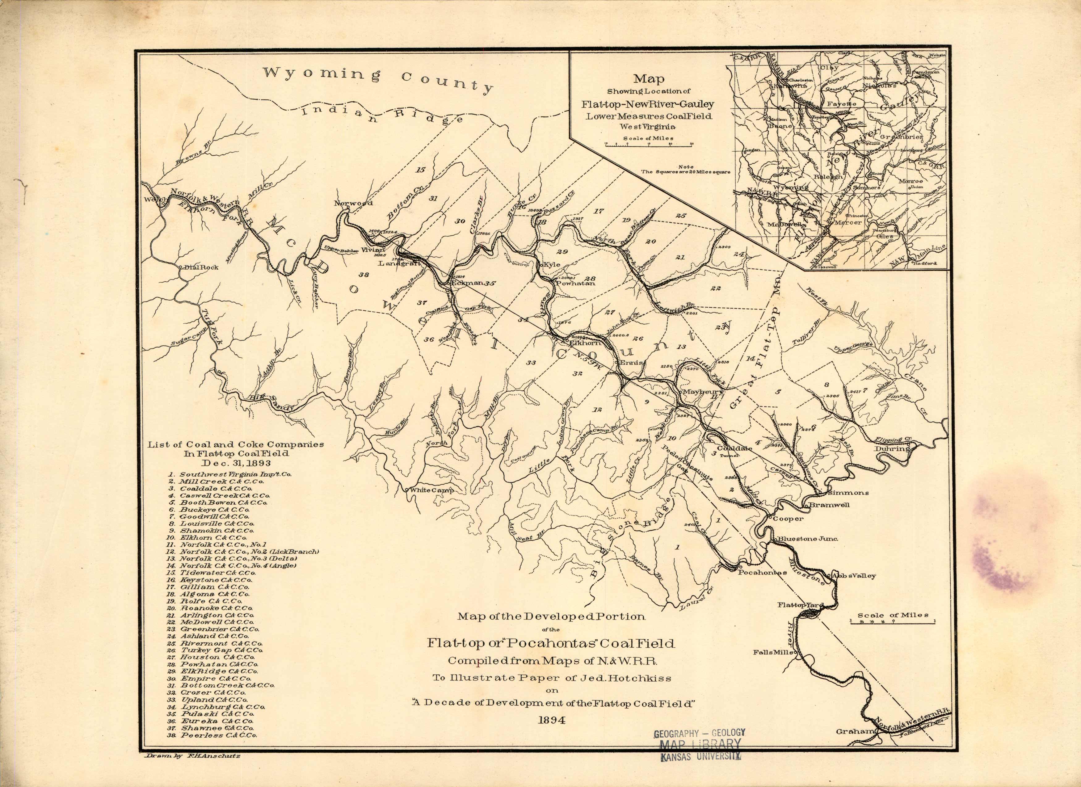
West Virginia – Map of the developed portion of Flat-Top Pocahontas Coal Field – New River – Gauley (Lower measures coal field)
Out of stock
Compiled from Maps of The Norfolk and Western Railway. This map depicts the 38 different coal and coke companies in the Flat-Top Coal Field Dec. 31,1893. Compiled for “A Decade of Development of the Flat-top Coal Field” 1894 by Jed Hotchkiss.
Size: 12 x 10 inches
Condition: Good Condition - border stain w/stamp from Kansas University w/in map boarder
Map Maker: Compiled from Maps of The Norfolk and Western Railway
Coloring: B&W
Year: 1893
Condition: Good Condition - border stain w/stamp from Kansas University w/in map boarder
Map Maker: Compiled from Maps of The Norfolk and Western Railway
Coloring: B&W
Year: 1893
Out of stock


